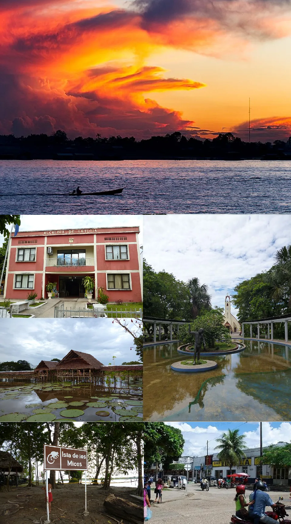
Leticia
City guide · Amazonas Department · Colombia
Tres Fronteras - the point where Colombia, Brazil, and Peru meet · Amazon River and surrounding rainforest
About Leticia
Leticia is Colombia's southernmost city, the capital of the Department of Amazonas, and a major port on the Amazon River. It sits at the Tres Fronteras point where Colombia, Brazil, and Peru meet, adjacent to the larger Brazilian city of Tabatinga. With an elevation of 96 meters and an average temperature of 27°C, Leticia has a tropical rainforest climate with consistently high humidity and rainfall year-round. The city has long been Colombia's shipping point for tropical fish for the aquarium trade and is a recognized tourist site, with tourism and agriculture as prime sources of income. Its population is largely made up of migrants from Bogotá, Medellín, and Tolima, alongside significant native Amerindian communities including the Witoto, Inga, Tucano, Ticuna, and Nukak peoples. Leticia's cuisine reflects Brazilian and Peruvian influences, with staples including river fish, rice, and locally-grown vegetables.
Who this destination fits
Highlights worth planning around
Strong fit
- Unique location at the Tres Fronteras border point, offering easy access to Brazil and Peru
- Rich biodiversity, with an intensive survey revealing 96 frog species in primary rainforest just 10 km north
- Distinct cultural mix with significant indigenous communities and migrant populations
- Gateway to the Amazon River and surrounding rainforest
- Tropical climate with warm temperatures year-round (average 27°C)
- Recognized tourist site with growing tourism infrastructure
Tradeoffs
- Very remote; access is primarily by air or river, with no road connection to the rest of Colombia
- High humidity and rainfall throughout the year, with the wettest month (March) seeing over 350 mm of rain
- Limited infrastructure compared to larger Colombian cities
- Small urban population (33,503 as of 2018), so amenities may be limited
- border disputes and a past armed conflict with Peru (Colombia-Peru War, 1932-1933) may concern some travelers
- Reliance on river transport can be affected by seasonal water levels
Plan the trip
Best time to visit
Leticia has a tropical rainforest climate with no distinct dry season, though July is the driest month (158.1 mm average precipitation) and March the wettest (357.9 mm). Travelers may prefer the relatively drier months of July and August for outdoor activities.
Planning lead time
Moderate planning recommended due to remote location and limited transport options; advance booking for flights and accommodations is advisable.
Decision factors
Getting around
Leticia is accessible primarily by air or river. It is adjacent to the Brazilian city of Tabatinga, and together with the Peruvian city of Santa Rosa de Yavari, the urban area spans the Amazon River. No road connection to the rest of Colombia is mentioned in admitted sources.
Trip Budget Calculator for Leticia
Estimate your travel expenses based on duration, style & group size
Global planning baseline. Flights use a generic estimate.
* Commission may be earned from qualifying partner bookings.


![4X Travel Adapter Plugs for EUROPE FRANCE SPAIN GREECE Purple [2-Ports + SURGE]](https://i.ebayimg.com/images/g/zO4AAOSwpbxg64no/s-l225.jpg)