Ha Giang
HomeDestinationsVietnamHa Giang

Ha Giang

City guide · Northeast Vietnam · Vietnam

Verified Aug 14, 2026

Ha Giang Loop motorbike route along QL4C · Lũng Cú and Lung Cu Flag Tower

About Ha Giang

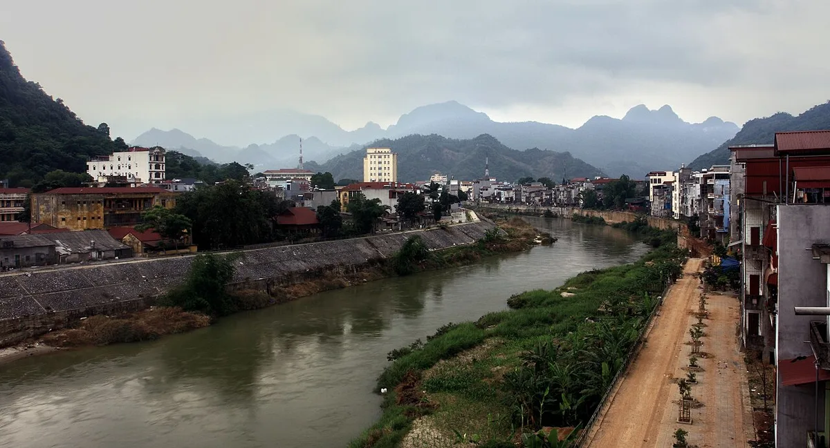
Ha Giang is a city in Northeast Vietnam, situated on the banks of the Lô River. It serves as the primary starting point for the Ha Giang Loop, a motorbike route along QL4C that passes through Lũng Cú, Đồng Văn district, Sà Phìn, and Mèo Vạc. The city covers 135.33 km² and had a population of 55,559 as of the 2019 census, comprising 22 ethnicities, with Kinh and Tày peoples making up 55.7% of residents. The area has been described as 'the most beautiful place in all of Vietnam.' The province is highly mountainous, with much land covered by forests, and its central plateau supports plums, peaches, persimmons, and tea cultivation. Ha Giang Province is among Vietnam's poorest, historically reliant on agriculture and forestry, with infrastructure less developed than other regions. Tourism has grown since the Dong Van Karst Plateau Geopark designation in 2010.

Who this destination fits

Motorbike enthusiasts planning the Ha Giang LoopAdventure travelers seeking mountainous landscapesCultural travelers interested in ethnic minority communitiesBackpackers exploring northern VietnamPhotographers drawn to karst plateau scenery

Highlights worth planning around

Ha Giang Loop motorbike route along QL4C (SOURCE_URL: https://en.wikipedia.org/wiki/Ha_Giang, SOURCE_ROLE: EDITORIAL_CONTEXT)
Lũng Cú and Lung Cu Flag Tower (SOURCE_URL: https://en.wikipedia.org/wiki/Ha_Giang, SOURCE_ROLE: EDITORIAL_CONTEXT)
Đồng Văn district (SOURCE_URL: https://en.wikipedia.org/wiki/Ha_Giang, SOURCE_ROLE: EDITORIAL_CONTEXT)
Sà Phìn (SOURCE_URL: https://en.wikipedia.org/wiki/Ha_Giang, SOURCE_ROLE: EDITORIAL_CONTEXT)
Mèo Vạc (SOURCE_URL: https://en.wikipedia.org/wiki/Ha_Giang, SOURCE_ROLE: EDITORIAL_CONTEXT)
Dong Van Karst Plateau Geopark (designated 2010) (SOURCE_URL: https://en.wikipedia.org/wiki/Ha_Giang, SOURCE_ROLE: EDITORIAL_CONTEXT)

Strong fit

  • Popular starting point for the Ha Giang Loop motorbike route (SOURCE_URL: https://en.wikipedia.org/wiki/Ha_Giang, SOURCE_ROLE: EDITORIAL_CONTEXT)
  • Home to 22 different ethnicities, offering cultural diversity (SOURCE_URL: https://en.wikipedia.org/wiki/Ha_Giang, SOURCE_ROLE: EDITORIAL_CONTEXT)
  • Central plateau grows plums, peaches, persimmons, and tea (SOURCE_URL: https://en.wikipedia.org/wiki/Ha_Giang, SOURCE_ROLE: EDITORIAL_CONTEXT)
  • Tourism industry growing since Dong Van Karst Plateau Geopark designation in 2010 (SOURCE_URL: https://en.wikipedia.org/wiki/Ha_Giang, SOURCE_ROLE: EDITORIAL_CONTEXT)
  • Described as 'the most beautiful place in all of Vietnam' (SOURCE_URL: https://en.wikipedia.org/wiki/Ha_Giang, SOURCE_ROLE: EDITORIAL_CONTEXT)

Tradeoffs

  • Ha Giang Province is one of the poorest provinces of Vietnam (SOURCE_URL: https://en.wikipedia.org/wiki/Ha_Giang, SOURCE_ROLE: EDITORIAL_CONTEXT)
  • Infrastructure remains poor, with roads, schools, and health services less developed than other parts of Vietnam (SOURCE_URL: https://en.wikipedia.org/wiki/Ha_Giang, SOURCE_ROLE: EDITORIAL_CONTEXT)
  • Much of the province is too mountainous for agriculture (SOURCE_URL: https://en.wikipedia.org/wiki/Ha_Giang, SOURCE_ROLE: EDITORIAL_CONTEXT)
  • Heavy rainfall from May to August, with July averaging 545.3 mm (SOURCE_URL: https://en.wikipedia.org/wiki/Ha_Giang, SOURCE_ROLE: EDITORIAL_CONTEXT)
  • Limited manufacturing industry, with economy traditionally revolving around agriculture and forestry (SOURCE_URL: https://en.wikipedia.org/wiki/Ha_Giang, SOURCE_ROLE: EDITORIAL_CONTEXT)

Plan the trip

Best time to visit

October to April, when rainfall is lower (October: 153.6 mm, November: 84.1 mm, December: 42.2 mm, January: 40.1 mm, February: 38.8 mm, March: 64.6 mm, April: 106.2 mm) compared to May–September (SOURCE_URL: https://en.wikipedia.org/wiki/Ha_Giang, SOURCE_ROLE: EDITORIAL_CONTEXT)

Planning lead time

Several days to a week recommended for the Ha Giang Loop route

Decision factors

Safety

No current safety data available from admitted sources

Getting around

Motorbike is the common mode for the Ha Giang Loop along QL4C (SOURCE_URL: https://en.wikipedia.org/wiki/Ha_Giang, SOURCE_ROLE: EDITORIAL_CONTEXT)

Experiences

Products for this trip